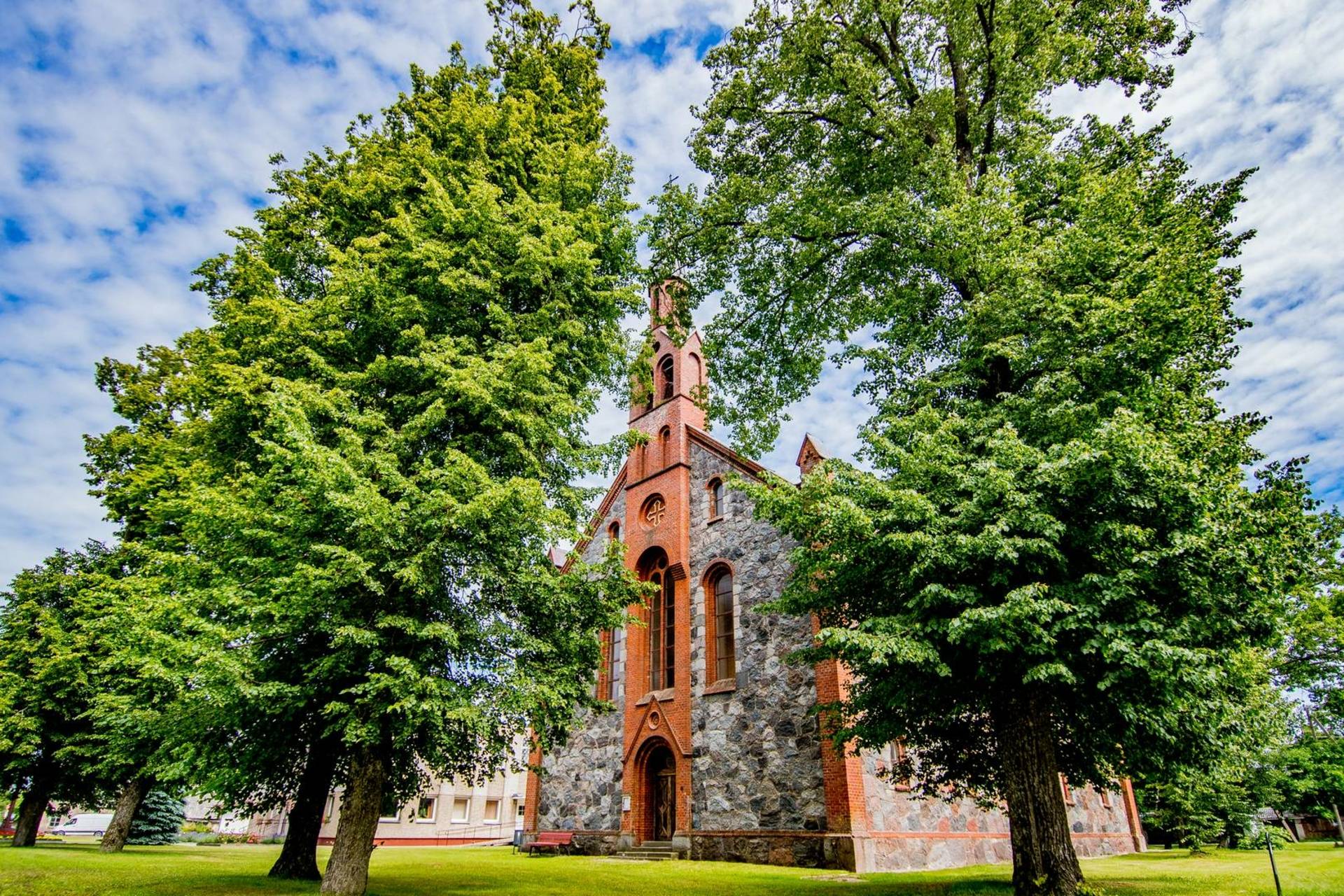
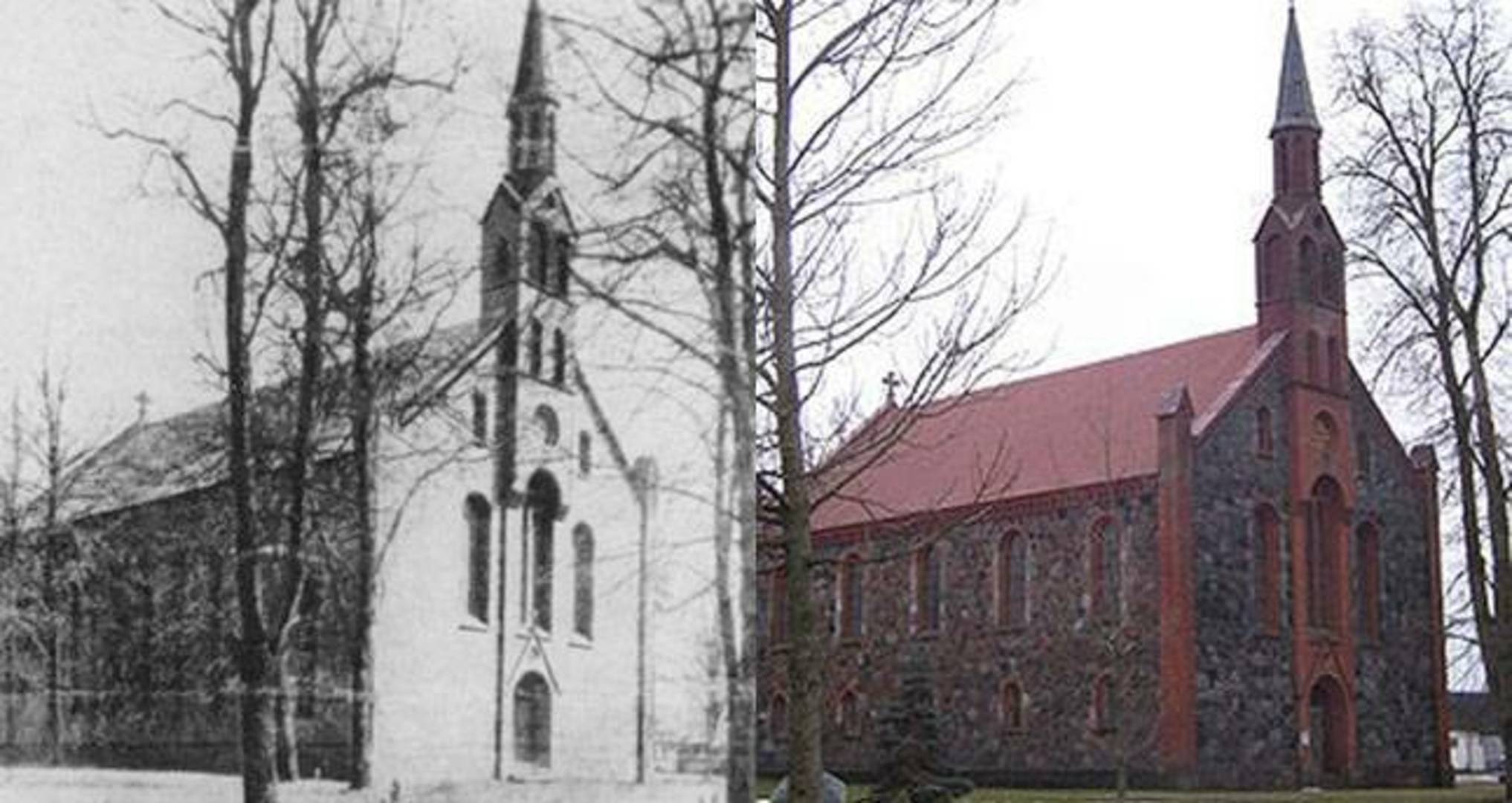
Dovilai is a historical settlement of what was the border area of Lithuanian Minor with a neo-Gothic Evangelical Lutheran Church. The town is connected to the tourist bicycle route ‘Catching the Winds of the Seaside’, which stretches all the way to the city of Liepaja in Latvia. Dovilai Ethnic Culture Centre actively hosts various calendar celebrations, exhibitions, Lapužis folk ensemble shows, educational activities, and offers ethno tourism routes.
The coordinates of the object: 55.677027, 21.359287
Other objects you can visit nearby include:
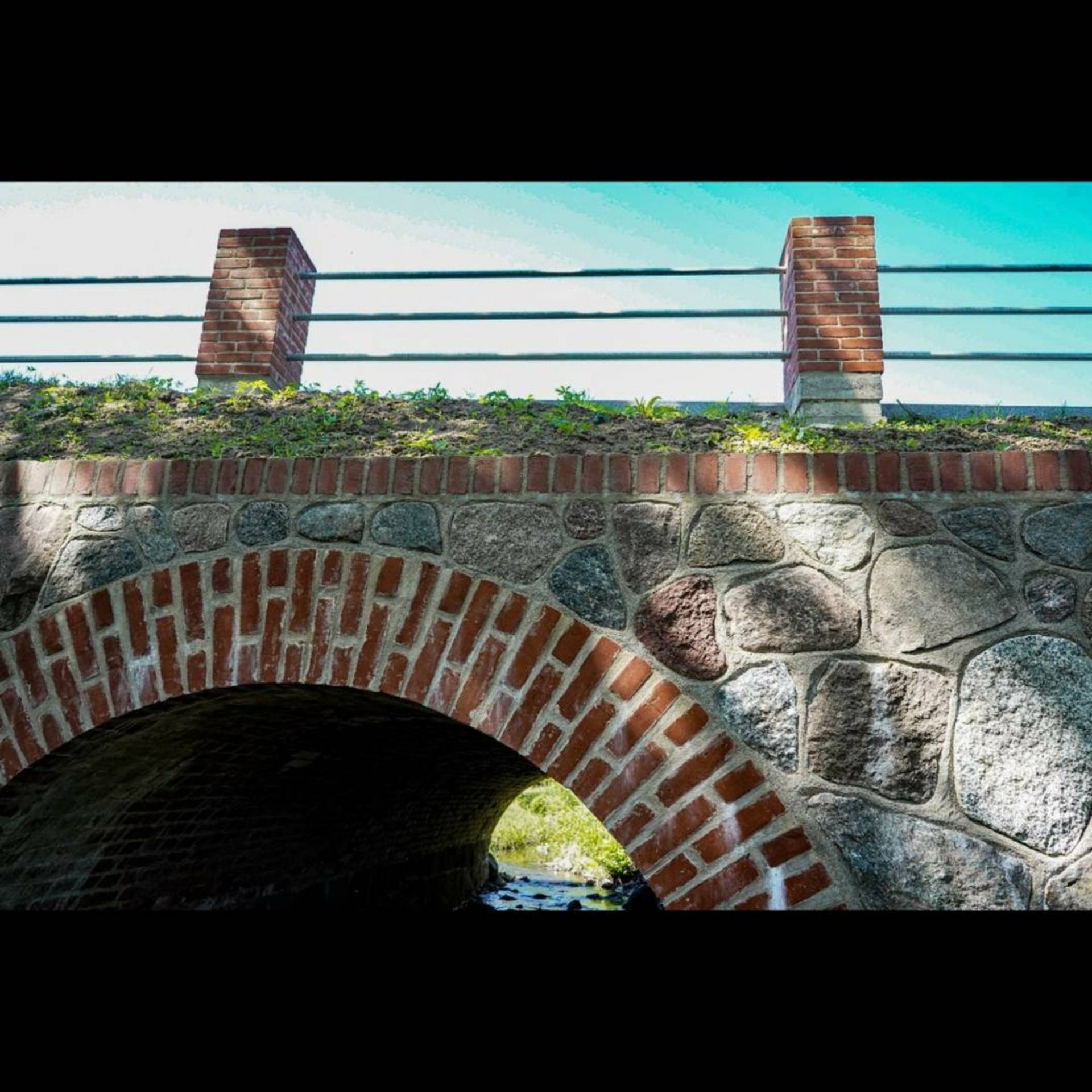
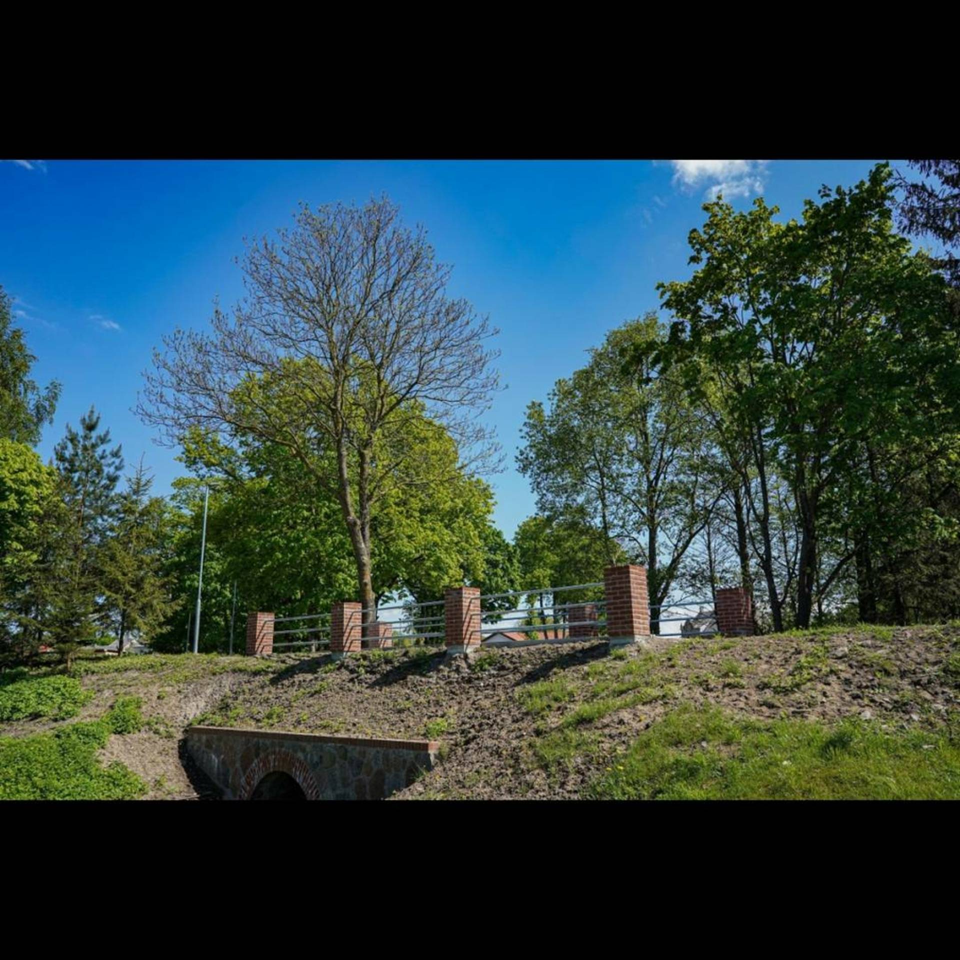
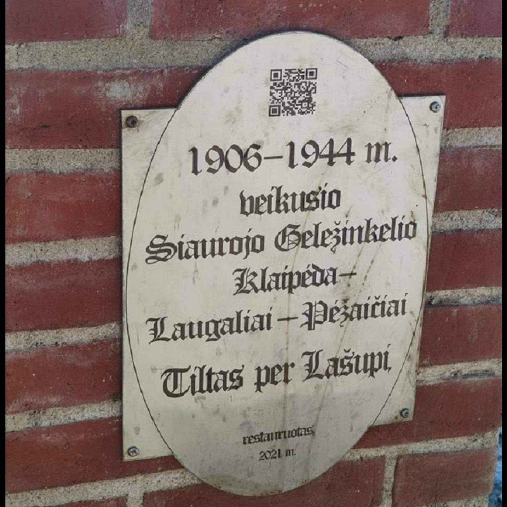
Narrow-gauge Railway Bridge
In 1904, it was decided to build a narrow-gauge railway connecting Klaipėda, Dovilai, and Pėžaičiai. Back in the day, travelling on a narrow-gauge railway was a sign of advancing society. Crowds of Klaipėda citizens used to come to Dovilai to relax, while ladies enjoyed a cup of kafija. There was also trade, a stone worker, a brick factory, various materials coming to and from the town, and farmers taking their produce to sell in Klaipėda. The narrow-gauge railway made Dovilai an economically-advanced town. The narrow-gauge railway bridge over Lašupis rivulet was reconstructed in 2021.
The coordinates of the object: 55.6781650, 21.3583647
Dovilai Ethnic Culture Centre (Gargždų g. 1, Dovilai)
Dovilai Ethnic Culture Centre is established in one of the few remaining old buildings, located in Dovilai town centre. This place has been known for its cultural activities, hosting performances, and dance nights and afternoons, since the interwar period. In the soviet era, the same building hosted the culture centre, which continued its activities after the restoration of independence as well. The culture centre was reorganised into Dovilai Ethnic Culture Centre on the 1 February 2005.
Address of the object: Gargždų g. 1, Dovilai, koordinatės: 55.67752, 21.35968
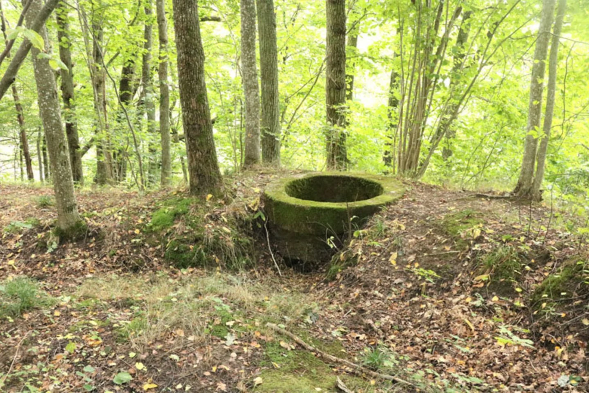
Dovilai Mound
Although the mound, dated back to the 1st-mid. 2nd millennium, is a pre-historic culture monument, located a little further from the former East Prussia – GDL border (later the Russian Empire and the Republic of Lithuania), it also features remains of defensive fortifications, dating back to World War II. The slopes in the south-western and north-eastern sides were formed in the pre-historic times. During World War II, the mound was included into Klaipėda’s defensive system.
The mound itself is located on the upland spur on the right bank of Minija river. It features an elongated rectangular top, which is 110 m long, 20-25 m wide, and has a 0.5 m high and 6 m wide elevation on the SW side. The NE side has an elevation that is 2.5 m high and 15 m wide with the outer 7 m slope continuing down into a natural ditch, which is 30 m wide and 2 m deep, separating the mound from the upland, located further in the NE.
There are two stories about this mound. One of them says that there was a huge fortress, inhabited by the Lithuanian Duke Gediminas. The dungeons of that fortress were full of treasure, guarded by an enormous dog to this day. Other stories say that the fortress on the mound was ruled by the Duke Dovilanas, bravely defending his lands from the enemy. Realising that the enemy is too strong, he struck their pagan altar with his sword and cursed both the enemy and the fortress. The fortress then sunk into the ground, leaving the mound empty.
Some other stories say that in the mound there is the grave of Gedminas, an ally and relative of the Duke Gediminas, and a brave warrior, and that the excellent fortress that used to stand on the mound sunk into the ground cursed by an evil priestess. Some say that the mound used to have a very deep hole that couldn’t be measured even with a long stick. Some others – that there was a deep cave. People used to listen for the devils counting their money in the underground, while shepherds used to be visited by a strange German lord, coming out from the cave.
The coordinates of the object: 55.66404, 21.33940

.jpg)